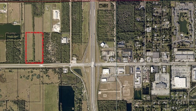
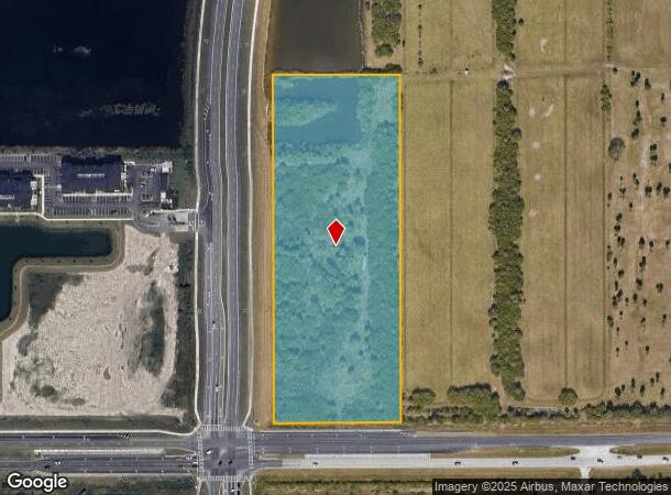
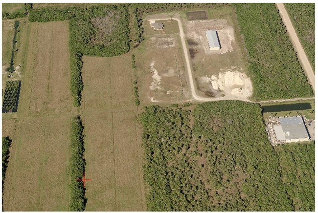
Property Record
1909 Unknown, Melbourne, FL 32904

NEARBY LISTINGS FOR SALE OR LEASE
-
-
-
-
-
-
-
-
-
-
Minton Rd & Heritage Oaks blvd
West Melbourne, FL 32904
$600,000 - $3,500,000
0.53 - 2.28 AC Lot
Land
-
-
View all Melbourne listings for sale on LoopNet.com
Property Detail
1909 Unknown
Palm Bay-Melbourne-Titusville, FL
Florida Indian River Land Company
28-36-03-00-00253.0-0000.00
W 1/2 OF SE 1/4 OF NW 1/4 EXC W 261.20 FT, RD R/W
Residentialacreage
Brevard
AE
Florida
12009C0579G
10.26 AC
2024
Brevard County
2025
Orlando
071354
DEMOGRAPHICS near 1909 Unknown
1 mile
3 mile
5 mile
2024 Total Population
1,249
18,612
78,852
2029 Population
1,391
20,503
86,138
Pop Growth 2024-2029
+ 11.37%
+ 10.16%
+ 9.24%
Average Age
42
43
43
2024 Total Households
499
7,294
31,035
HH Growth 2024-2029
+ 11.02%
+ 9.84%
+ 9.07%
Median Household Inc
$73,851
$77,392
$68,987
Avg Household Size
2.40
2.40
2.40
2024 Avg HH Vehicles
2.00
2.00
2.00
Median Home Value
$287,085
$291,498
$247,430
Median Year Built
1993
1989
1988
Nearby Places
Map Layers
Map Styles
 Street
 Aerial
Transit
 Traffic
 Biking
Places
Listings with unknown addresses are not visible on the map
- Restaurants
- Banks
- Shops
- Fitness
- Groceries
PUBLIC TRANSPORTATION
AIRPORT
Melbourne Orlando International
Drive
Walk
Distance
Melbourne Orlando International
14 min
6.6 mi
Freight Ports
Port Canaveral
Drive
Walk
Distance
Port Canaveral
44 min
34.9 mi
SALE & LEASE HISTORY
LISTING DATE
SALE/LEASE

Apr 11, 2017
For Sale
Nearby Properties
Address
Land Use
TOTAL SIZE
Lot Size
Zoning
Address
Land Use
TOTAL SIZE
Lot Size
Zoning
433,669 SF
21.22 AC
AU
Address
Land Use
TOTAL SIZE
Lot Size
Zoning
425,167 SF
43.33 AC
Address
Land Use
TOTAL SIZE
Lot Size
Zoning
384,430 SF
33.07 AC
R2
Address
Land Use
TOTAL SIZE
Lot Size
Zoning
389,175 SF
12.18 AC
Address
Land Use
TOTAL SIZE
Lot Size
Zoning
261,552 SF
23.21 AC
R2
Address
Land Use
TOTAL SIZE
Lot Size
Zoning
196,130 SF
16 AC
Address
Land Use
TOTAL SIZE
Lot Size
Zoning
16,725 SF
66.98 AC
TRC1
Address
Land Use
TOTAL SIZE
Lot Size
Zoning
95,944 SF
17.22 AC
GU
Address
Land Use
TOTAL SIZE
Lot Size
Zoning
58,607 SF
2.79 AC
Address
Land Use
TOTAL SIZE
Lot Size
Zoning
163,449 SF
11.20 AC
M1
Address
Land Use
TOTAL SIZE
Lot Size
Zoning
130,907 SF
20 AC
M1
Address
Land Use
TOTAL SIZE
Lot Size
Zoning
193,940 SF
38.87 AC
Address
Land Use
TOTAL SIZE
Lot Size
Zoning
119,111 SF
6.88 AC
M1
Address
Land Use
TOTAL SIZE
Lot Size
Zoning
68,775 SF
7.57 AC
Address
Land Use
TOTAL SIZE
Lot Size
Zoning
52,145 SF
7.59 AC
Address
Land Use
TOTAL SIZE
Lot Size
Zoning
226,960 SF
21.49 AC
M1
Address
Land Use
TOTAL SIZE
Lot Size
Zoning
151,324 SF
16.12 AC
BU2
Address
Land Use
TOTAL SIZE
Lot Size
Zoning
140,826 SF
15.93 AC
M1
Address
Land Use
TOTAL SIZE
Lot Size
Zoning
68,558 SF
7.17 AC
M2
Address
Land Use
TOTAL SIZE
Lot Size
Zoning
119,767 SF
7.10 AC
M1
Address
Land Use
TOTAL SIZE
Lot Size
Zoning
49,296 SF
2.94 AC
BU-1
Address
Land Use
TOTAL SIZE
Lot Size
Zoning
55,076 SF
2.36 AC
Address
Land Use
TOTAL SIZE
Lot Size
Zoning
124,692 SF
10.47 AC
C
Address
Land Use
TOTAL SIZE
Lot Size
Zoning
96,854 SF
7.51 AC
CP
Address
Land Use
TOTAL SIZE
Lot Size
Zoning
33,726 SF
12.81 AC
BU1
Address
Land Use
TOTAL SIZE
Lot Size
Zoning
123,080 SF
10.02 AC
M1
Address
Land Use
TOTAL SIZE
Lot Size
Zoning
95,029 SF
8.53 AC
TU-2
Address
Land Use
TOTAL SIZE
Lot Size
Zoning
109,336 SF
9.87 AC
M1
Address
Land Use
TOTAL SIZE
Lot Size
Zoning
87,188 SF
3.40 AC
TU2
Address
Land Use
TOTAL SIZE
Lot Size
Zoning
145,061 SF
16.69 AC
CP
The World's #1 Commercial Real Estate Marketplace
Connect with us
© 2026 CoStar Group
The information above has been obtained from sources believed reliable. While we do not doubt its accuracy we have not verified it and make no guarantee, warranty or representation about it. It is your responsibility to independently confirm its accuracy and completeness. Any projections, opinions, assumptions, or estimates used are for example only and do not represent the current or future performance of the property. The value of this transaction to you depends on tax and other factors which should be evaluated by your tax, financial, and legal advisors. You and your advisors should conduct a careful, independent investigation of the property to determine to your satisfaction the suitability of the property for your needs.